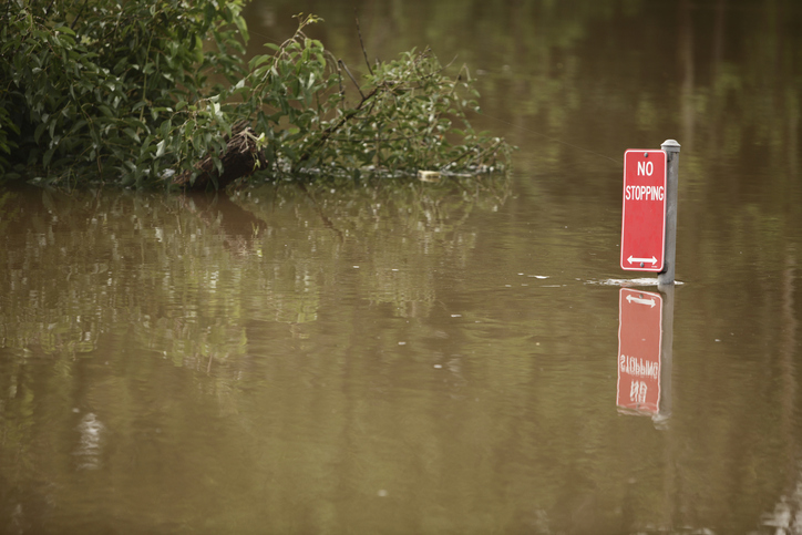
Think Victoria and disasters and you’ll think bushfires. But floods can hit – just not as often.
Today is one of those days, with much of the state under a flood watch. Premier Dan Andrews says the floods are likely to be the most significant in years. Evacuations are likely.
Floodwaters are pushing down the Goulburn to the Murray. Major flooding in the Maribyrnong, which runs through towns and Melbourne’s west. Emergency services say evacuations may be necessary. Towns are sandbagging flood-prone areas. Some have been cut off by rising waters.
The state’s largest dam, Dartmouth, is spilling over. So is Lake Eildon’s dam. And the Thomson dam may well spill this weekend, for the first time in decades. This isn’t the last of it – Victoria’s emergency management commissioner Andrew Crisp has warned intense rains and floods could last up six to eight weeks.
Even as the rest of the eastern seaboard has faced the brunt of three consecutive La Niña years, Victoria has had little flooding until now. Tasmania, too, is facing rare flooding, while flood-weary New South Wales is bracing for more.
These heavy rains are unusual. Dense cloud bands have crossed the desert, carrying moisture evaporating from seas off north-west Australia. Rain has fallen across almost the entire continent in the last two weeks. Our rain events are usually regional – not national.
Why doesn’t Victoria have as many floods?
Victoria’s claim to fame in disasters is that it’s the most bushfire-prone region in the world (followed by California and Greece).
Fire risk also comes from climate. Victoria’s temperate climate means dry summers and less rain than its northern counterparts – around 520 millimetres of rain a year falls on average in Melbourne, compared to 1175mm a year in Sydney and 1149mm in Brisbane. Up north, rain tends to fall intensely, whereas Victoria’s rain tends to fall more as drizzle.
What’s different this time? September was wetter and colder than usual in Victoria, which meant the ground was already saturated in many areas. Colder weather means less water evaporates. Together, that made the state primed for floods.
For a flood to happen, you need a high rate of run-off, where rain hits saturated soils and flows overland rather than sinking in, as well as intense rains in a short period.
Victoria is more familiar with flash floods. That’s because the stormwater drains in cities and towns can be overwhelmed by sudden dumps of rain, flooding streets. The good news is this flooding is usually over quickly, in contrast to the flooded rivers we see up north.
This situation may be different. With the state’s major dams beyond capacity or very close to it, water is already spilling over. Dams in Australia are often dual-purpose, storing drinking water and allowing us some control over floods. While Brisbane’s dams are designed with gates to permit floodwater release, Victoria’s dams tend to just have dam walls.
When dams overflow, they can add to floods in low-lying areas downstream. There’s also usually a lag time in riverine floods, as it takes hours or sometimes days for rain falling in the headwaters to end up as floodwater downstream.
What floods has Victoria seen before?
The largest was in 1934. More than 140mm of rain fell over two days in Melbourne, and more than double that in Gippsland. The enormous flood that followed was most devastating in Melbourne, where the Yarra broke its banks and formed a lake from the city out to the outer suburbs. Thirty-six people died, and thousands of people were left homeless.
Floods in the capital and in the regions are rare but not unknown. In 1891, floods forced more than 3,000 people from their homes in Richmond, Collingwood and Prahran. In 1909, western Victorian rivers broke their banks, flooding many towns and causing four deaths.
The most recent big floods took place during the previous La Niña cycle from 2010-2012, with western Victoria taking the brunt of the damage.
Flooding in Victoria has also reduced because people have shifted the course of rivers – particularly the Yarra.
In 1879, 2,000 workers began a monster task: removing an entire loop of the Yarra west of the Docklands. One reason? Straight rivers flow faster, meaning floodwaters can discharge more quickly.
Engineer John Coode was responsible for designing the new course for the Yarra, which also had the benefit of a wide new channel to improve access for ships. In the process, his workers created what’s now known as Coode Island.
In 1896, Victoria’s Parliament passed the Yarra Improvement Act in a bid to reduce the damage caused by floods. Workers widened and deepened the river, and removed billabongs near the Botanic Gardens in the process.
In the 1930s, engineers built another channel through an old quarry leading to the creation of Herring Island. These changes were mainly about improving navigation for ships – but they had the double benefit of reducing flooding in the lower reaches. In part, it was about British ideals of what rivers should look like, using highly modified rivers like London’s Thames as a guide.
What’s next?
Changing the course of rivers, raising dams and building levees can make us feel like we’re in control. Unfortunately, it’s not that simple, as Lismore’s residents found.
Flood control measures can actually make the impact of large floods worse by giving us a false sense of security about living on floodplains.
This is unlikely to be the last flood before La Niña finally relents. It’s worth knowing your state’s history of disasters – so you can be better prepared. After all, we can’t control nature. ![]()
Margaret Cook, Lecturer in History, University of the Sunshine Coast
This article is republished from The Conversation under a Creative Commons license. Read the original article.
Media enquiries: Please contact the Media Team media@usc.edu.au

